Prerequisite:
An active HUB Subscription and API access token or your MapStand Account username/password.
To locate your API access token, follow these instructions ....API Access Token
Using MapStand's OGC web services you can avoid the complexities of exporting and importing data. Simply add a new data collection in your GIS application (ArcGIS, QGIS, OpenLayers, Google Earth or any other app supporting standard services) and start using the data right away!
The following guide will help you setup different OGC services, understand the structure, show you how to run the requests in different environments and how it can be integrated with QGIS, ArcGIS and web applications.
WMS Request
[Reference: https://docs.geoserver.org/latest/en/user/services/wms/reference.html]
A Web Map Service (WMS) is a standard protocol developed by the Open Geospatial Consortium in 1999 for serving georeferenced map images over the Internet. These images are typically produced by a map server from data provided by a GIS database
The MapStand WMS service conforms to the WMS standard.
Access to the service is via a custom server instance URL which will be provided to you upon subscribing.
The base URL for the WMS service is:
https://hub.mapstand.com/gs/ows?VERSION=1.1.0&apikey=<your API Access Token>
(Use gs proxy for access to both Production and Development datasets)
or
https://hub.mapstand.com/geoserver/ows?VERSION=1.1.0&apikey=<your API Access Token>
(Use geoserver for access to only Production datasets)
Accessing datasets in QGIS via OGC WMS
Accessing datasets on QGIS via OGC web services
WFS Request
The MapStand WFS service conforms to the WFS standard.
It provides access to the geometric (vector) metadata about the available data collection tiles. As with the WMS service, WFS is also only available via a user-preconfigured custom server instance URL.
The base URL for the WFS service is:
https://hub.mapstand.com/gs/ows?VERSION=1.3.0&apikey=<your API Access Token>
The gs proxy server will return both production and development datasets.
or
https://hub.mapstand.com/geoserver/ows?VERSION=1.3.0&apikey=<your API Access Token>
Accessing the data using the geoserver url will give access to only the Production datasets
Note: Downloading datasets sometimes results in a 504 Gateway Time-out error - please take a look at this support article: 504 Gateway Error
WFS is not ideal for large datasets. We recommend the geoserver URL for the Production (mps) datasets and the gs URL with API access token for the Development datasets (phoenix).
Accessing datasets in QGIS via OGC WFS
Accessing datasets on QGIS via OGC web services
Accessing datasets in ArcGIS Pro via WFS Server Connection

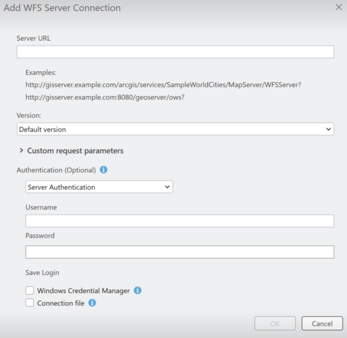
In the Catalog pane, expand Servers and then the new WFS connection you've just created - "WFS on hub.mapstand.com.wfs". After a few moments you will then be able to see a list of all the MapStand layers you have been given access to.

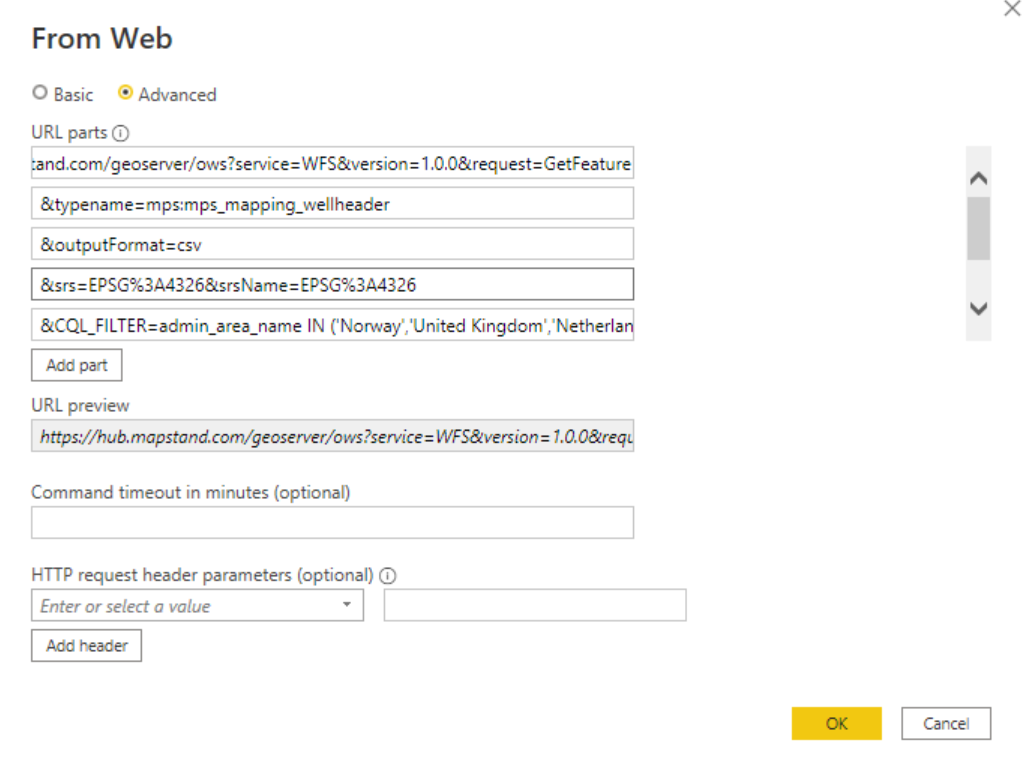
Accessing datasets in PowerBI
 > More ... then type Web into search bar and Select Web from the list, then click on Connect
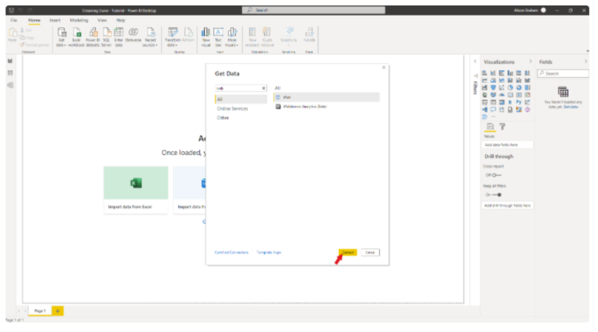
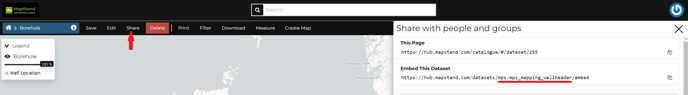
- To find out the name of the dataset file, view the dataset on the HUB and click on Share. For example the Borehole dataset = mps:mps_mapping_wellheader
- Click here to find out how to locate/generate your API Access Token .
-
Depending on the number of points in each dataset (https://learn.microsoft.com/en-us/power-bi/visuals/power-bi-data-points), you may need add the following URL part to filter the dataset: &CQL_FILTER=admin_area_name IN ('Norway','United Kingdom','Netherlands','Denmark') . This will extract only data from the North Sea.