The latest platform update will be made available on 18th Feb 2020.
Highlights
Mobile version
- Optimised user interface for mobile phone use
- Newsfeed, Community, Info and Layers panels now located in the bottom navbar.
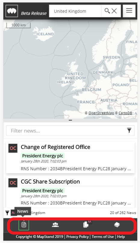
- For ease of viewing - the page has been split. The top half displays the map, the bottom half displays the panel selected. Can drag panel up or down to expand or reduce it.
- The map view has been simplified - 'pinch-to-zoom' instead of map controls. Basemap control removed.
- The Profile panel is no longer available on the mobile version. Adding work/education projects and adding an asset to you profile is only available in the desktop version.
- Help now available on the footer and as a dropdown link on the hamburger button
Desktop version
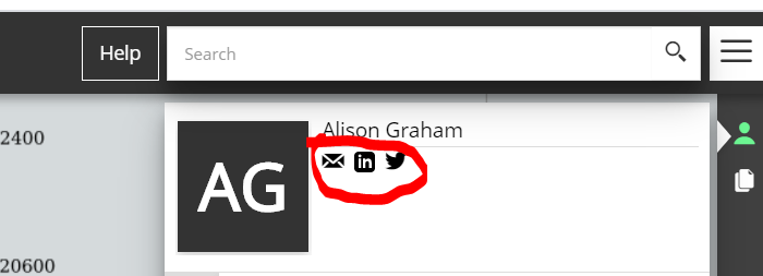
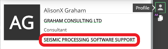
- To make it easier for other MapStand community members to contact you, contact links have been added to the Profile panel: email, linkedin, twitter and website
- New layers have been added: Rigs and Vessels have been separated, Planned 2D Seismic Surveys, Platforms, Floating Facilities, Terminals, Seabed Features, 2D Seismic Surveys (2D lines grouped into 2D surveys)
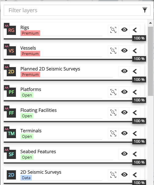
- Layer styles have been updated
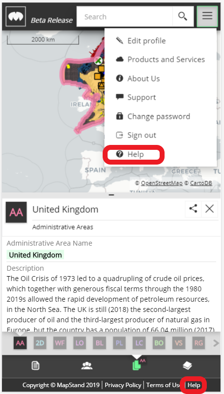
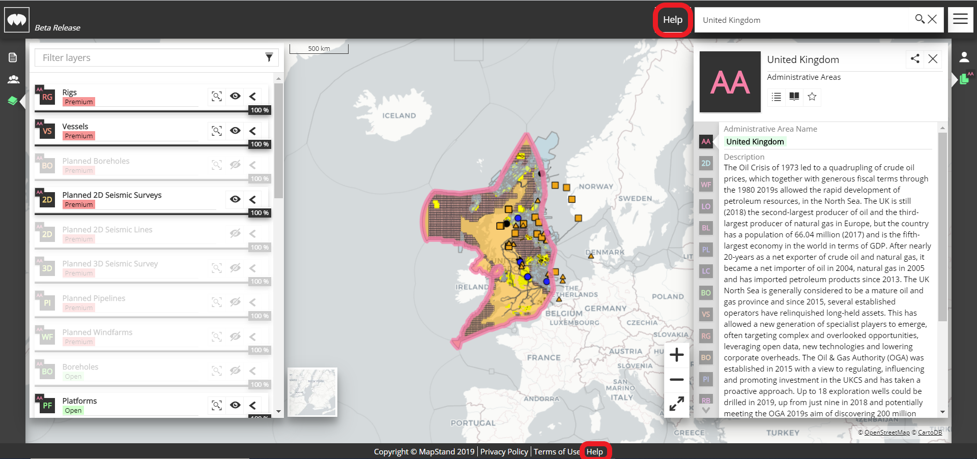
- The HELP button in now located on the navbar and footer.
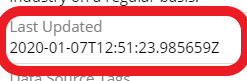
- The "last updated" field now has a date format (ddd, dd MMMM yyyy hh:mm tt).
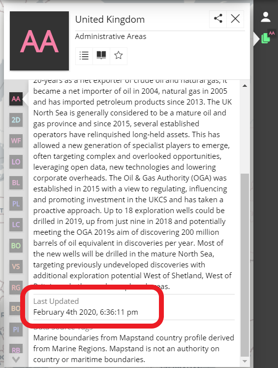
Previously had a timezone date format (yyyy-MM-ddTHH:mm:ssZ)
- Keywords are no longer displayed in the Profile panel
- The toolbar for adding a project/education/favourite to your profile has been placed horizontally (previously displayed vertically)