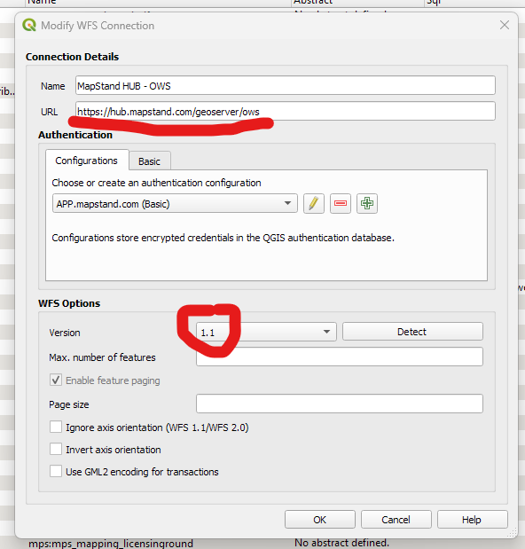
- Connect to the hub using the connection string https://hub.mapstand.com/geoserver/ows.
- In the Authentication > Configurations tab, select APP.mapstand.com (Basic) - you will be asked for your MapStand account username and password. Also, make sure version is set to 1.0 or 1.1 (as indicated below)
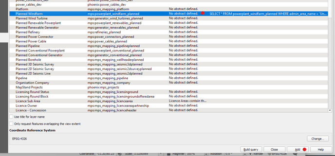
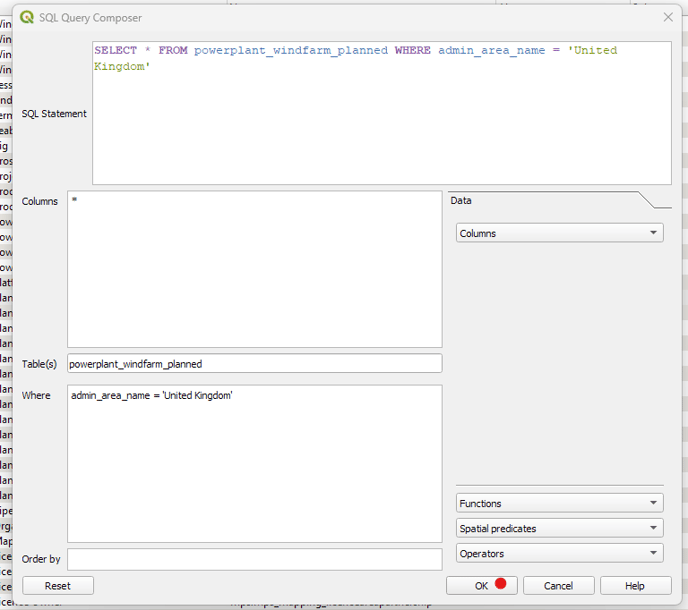
- Double-click on the layer you want to filter and add to QGIS. This will open the SQL Query Composer window.
- Next click in the WHERE box before selecting the column you want to filter from the Columns drop-down menu e.g. admin_area_name
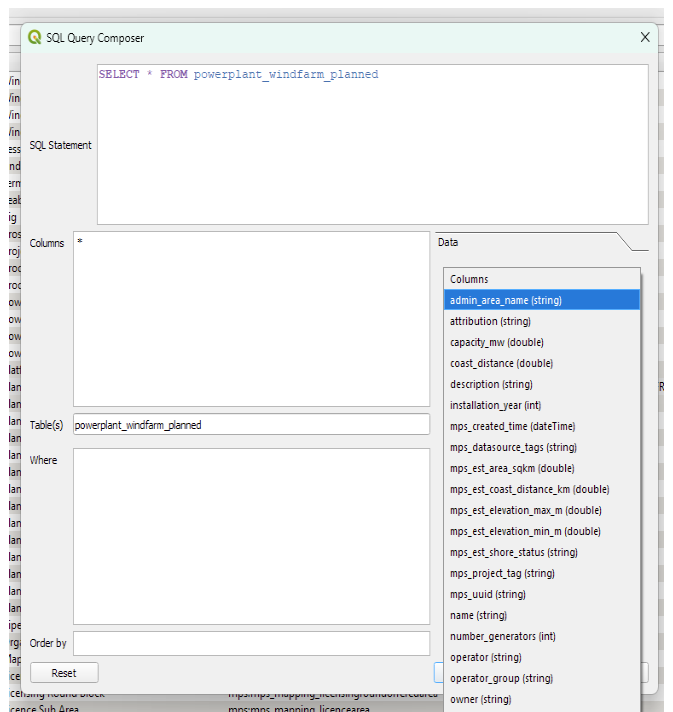
- Then select the Operator you wish to use (or Functions) e.g. =
- If you'd like to just add the Planned Windfarms from the UK, add 'United Kingdom' - in single quotes. Once happy with the SQL query, click on the OK button
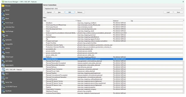
- Next make sure the layer you want to add to QGIS is highlighted, then click on the Add button to add that layer to QGIS