The MapStore based map viewer of GeoNode allows you to print the current view with a customizable layout.
Click the Print option from the Menu, the Printing Window will open.
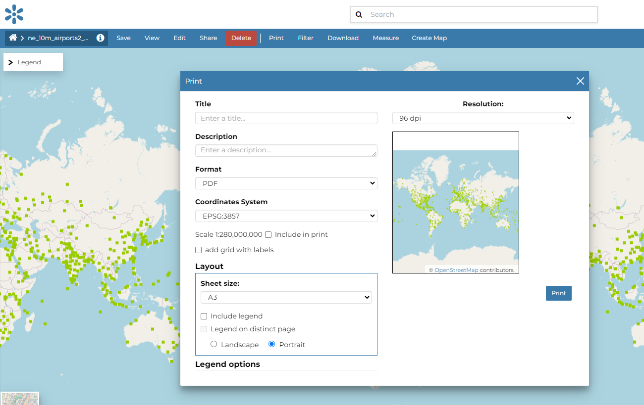
From this window you can:
-
enter Title and Description;
-
choose the Resolution in dpi;
-
customize the Layout
-
the Sheet size (A3, A4);
-
if include the legend or not;
-
if to put the legend in a separate page;
-
the page Orientation (Landscape or Portrait);
-
-
customize the Legend
-
the Label Font;
-
the Font Size;
-
the Font Emphasis (bold, italic);
-
if Force Labels;
-
if use Anti Aliasing Font;
-
the Icon Size;
-
the Legend Resolution in dpi.
-
To print the view click on Print.
Measure
Click on the Measure option of the Menu to perform a measurement. As you can see in the picture below, this tool allows you to measure Distances, Areas and the Bearing of lines.
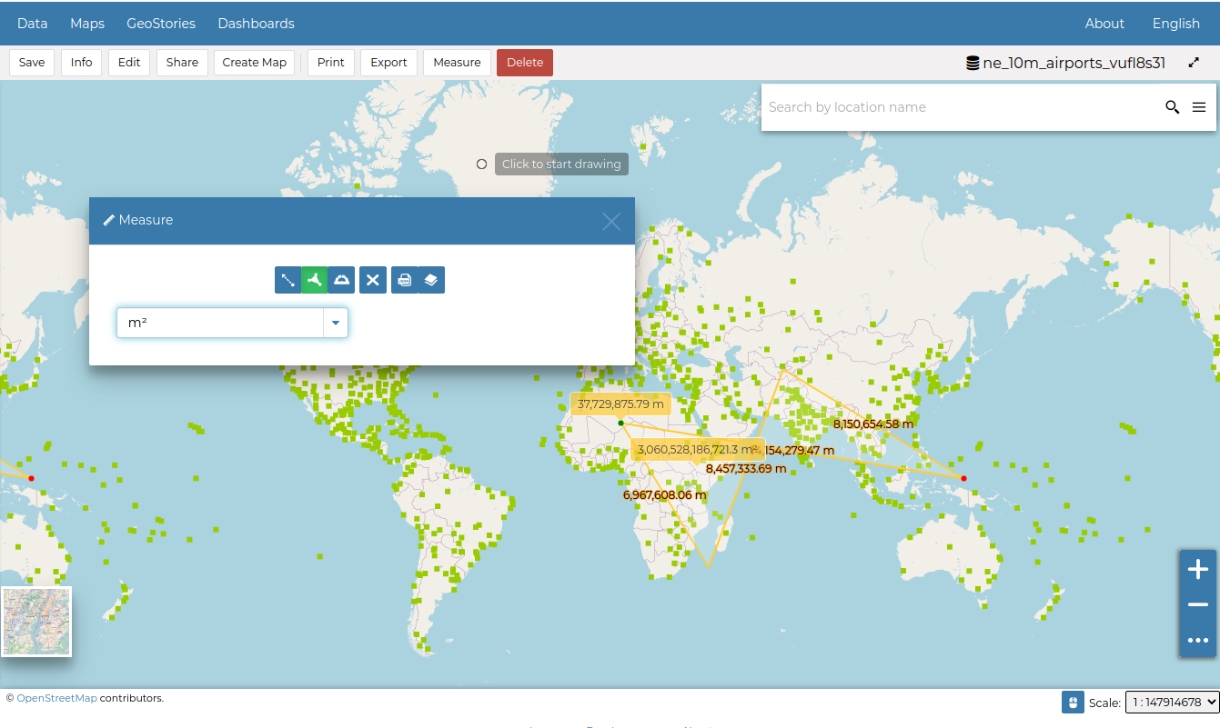
The Measure Tool