Geostories - Overview
GeoStory is a MapStore tool integrated in GeoNode that provides the user a way to create inspiring and immersive stories by combining text, interactive maps, and other multimedia content like images and video or other third party contents. Through this tool you can simply tell your stories on the web and then publish and share them with different groups of GeoNode users or make them public to everyone around the world.
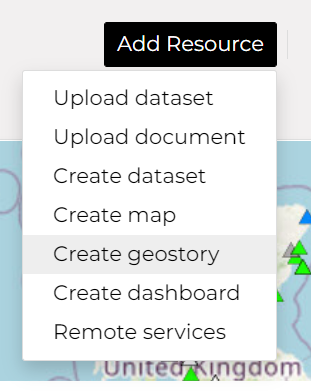
To build a new GeoStory click on the Add Resource button and choose option Create geostory.
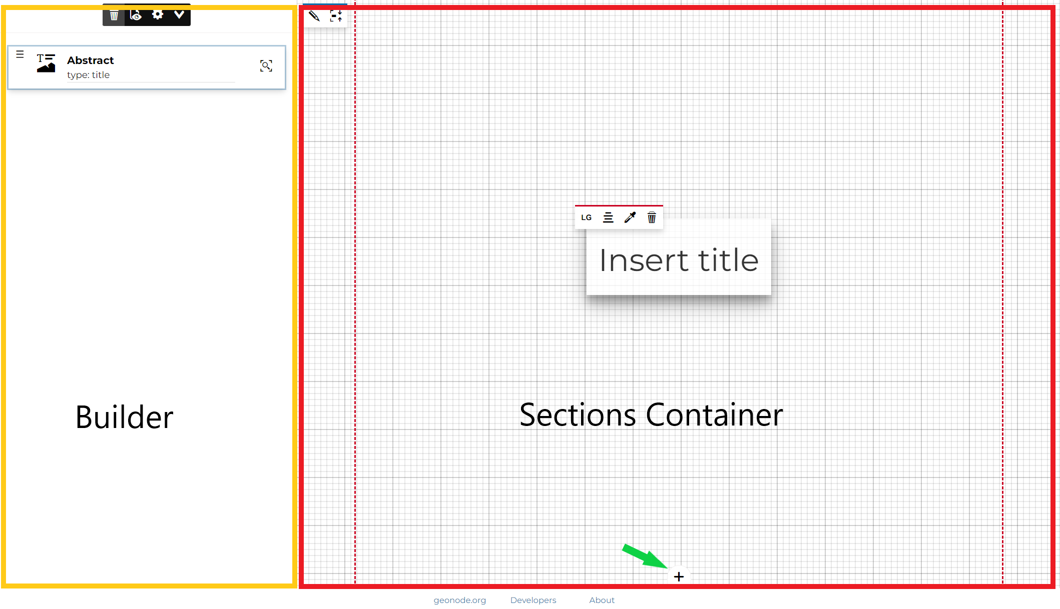
The GeoStory editor page is composed of two elements - the Builder and the Sections Container :
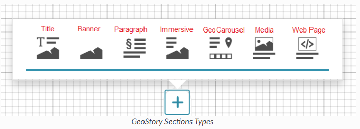
For more information on these specific section please follow the official MapStore documentation:
Add GeoNode content to GeoStory
With GeoNode you can add content to your GeoStory using internal GeoNode documents and maps as well external sources. This ability to add internal GeoNode content makes the GeoStory creation a very useful feature.
 button on top of your GeoStory section.
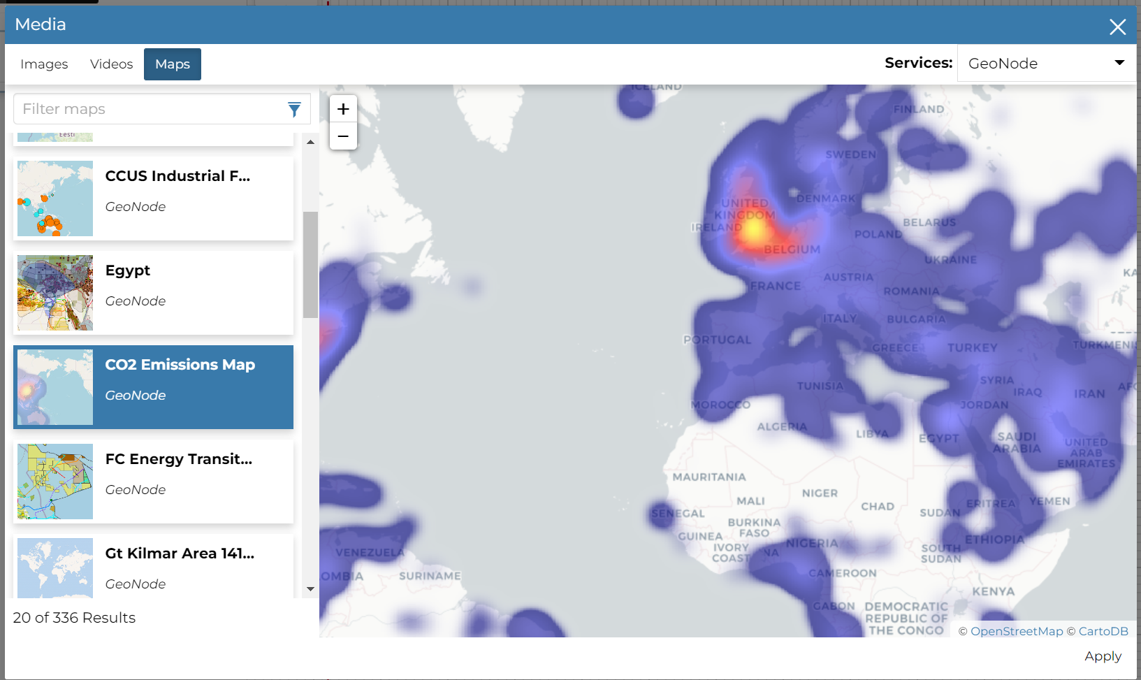
From here you can add Images, Videos and Maps. To enable GeoNode internal catalog, on Services dropdown choose GeoNode as shown. On the left you will see a list of media documents available with a text filter feature on top.
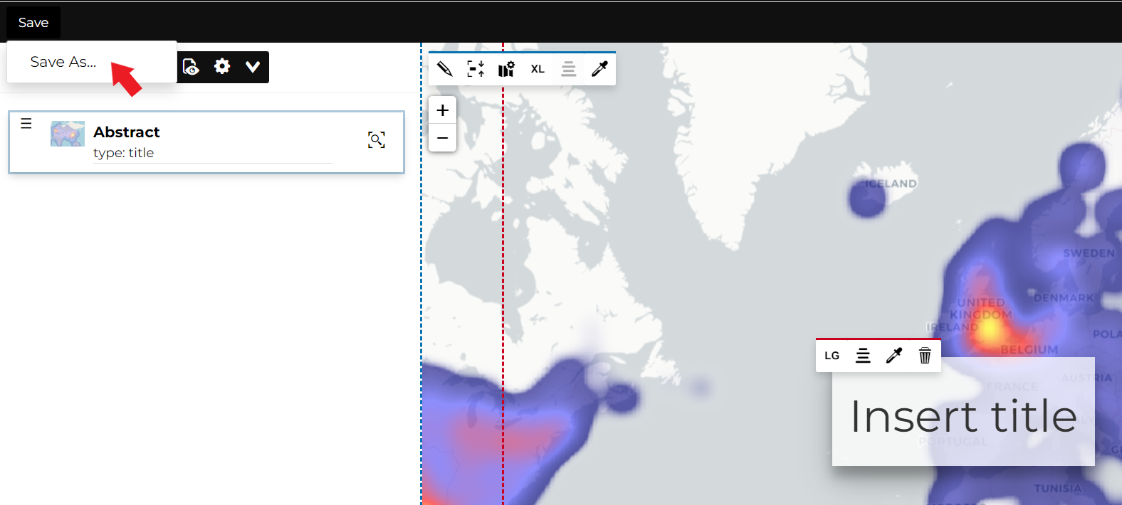
To save your GeoStory, on the top your Geostory content choose Save and then Save as…
Now your GeoStory can be shared with everyone in your group.
For more detailed information about the usage of GeoStory - please refer to the MapStore GeoStory Documentation
![logo-inverted-2.png]](https://support.mapstand.com/hs-fs/hubfs/logo-inverted-2.png?height=50&name=logo-inverted-2.png)