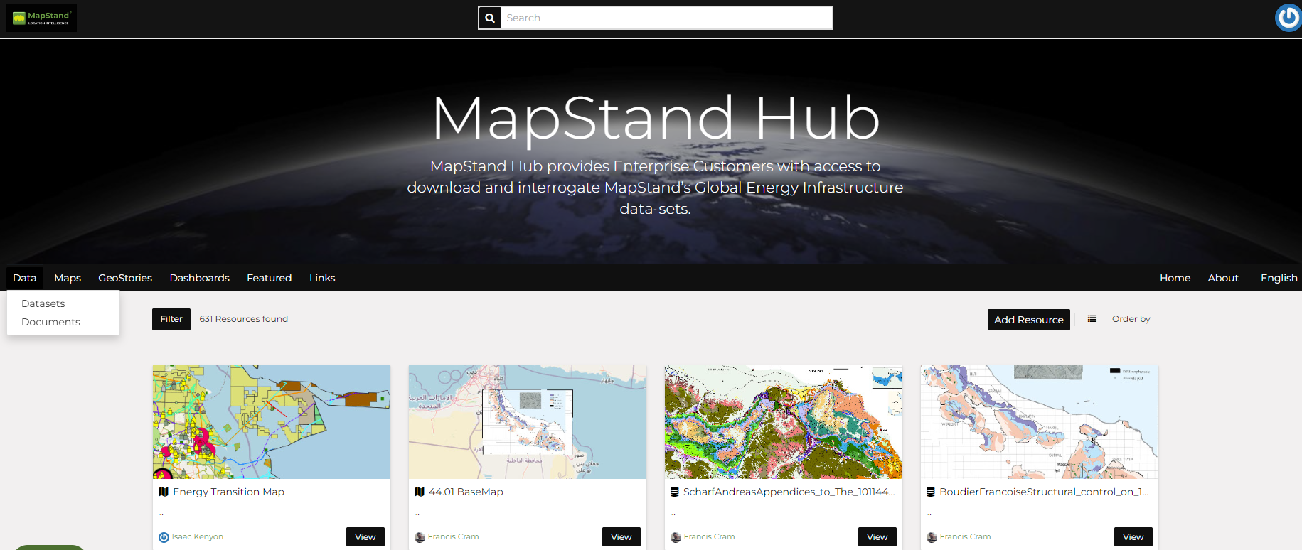
Data Types

Data Types

The MapStand Hub welcome page shows a variety of information about the current MapStand Hub instance.
You can explore the existing data using many search tools and filters (see Finding Data) or through the links of the navigation bar at the top of the page.
There are three main types of resources that the Hub can manage:
  1. Documents

  2. Datasets

  3. Maps

Datasets and Documents can be accessed from the Data menu of the navigation bar. The Maps menu lets you filter to display only maps. This applies to other menu items like GeoStories and Dashboards.

Data menu

Documents

MapStand Hub can publish tabular and text data and manage metadata and associated documents.
Documents can be uploaded directly from your disk (see Uploading Documents for further information).
Supported file extensions: .txt, .log, .doc, .docx, .ods, .odt, .sld, .qml, .xls, .xlsx, .xml, .bm, .bmp, .dwg, .dxf, .fif, .gif, .jpg, .jpe, .jpeg, .png, .tif, .tiff, .pbm, .odp, .ppt, .pptx, .pdf, .tar, .tgz, .rar, .gz, .7z, .zip, .aif, .aifc, .aiff, .au, .mp3, .mpga, .wav, .afl, .avi, .avs, .fli, .mp2, .mp4, .mpg, .ogg, .webm, .3gp, .flv, .vdo, .glb, .pcd, .gltf
By selecting View, it is possible to view (if a viewer is supported e.g. MS Word, Excel, PPT are not), download and manage the metadata of a document.

Datasets

Datasets are a primary component of MapStand Hub.
Datasets are a publishable resource, representing a raster or vector spatial data source. Datasets can also be associated with metadata, ratings, and comments.
By clicking the Datasets link you will get a list of all published datasets. If logged in as an administrator, you will also see the unpublished datasets in the same list.
MapStand Hub allows the user to upload vector and raster data in their original projections using a web form.

Vector data can be uploaded in many different formats (ESRI Shapefile, KML and so on…). Satellite imagery and other kinds of raster data can be uploaded as GeoTIFFs.

Maps

Maps are a primary component of MapStand Hub.
Maps are comprised of various datasets and their styles. Datasets can be both local datasets in MapStand Hub as well as remote datasets either served from other WMS servers or by web service datasets such as Google or MapQuest.

MapStand Hub maps also contain other information such as map zoom and extent, dataset ordering, and style.

You can create a map based on uploaded datasets, combine them with some existing datasets and a remote web service dataset, share the resulting map for public viewing. Once the data has been uploaded, MapStand Hub lets the user search for it geographically or via keywords and create maps. All the datasets are automatically re-projected to web mercator for maps display, making it possible to use popular base maps such as OpenStreetMap.